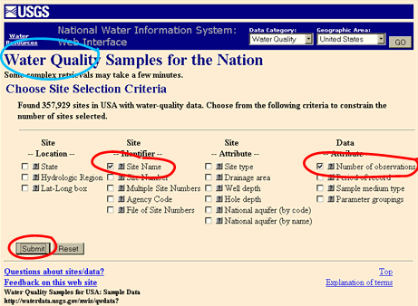
On the first page of the USGS Water Quality site dialogue, you're presented with "Site Selection Criteria". You may have all sorts of criteria for what sites you want. But also, always select:
- Number of observations
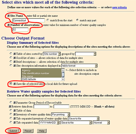
Then I clicked Submit.
Note that LoadRunner needs a minimum of 12 quality data points to run, so there's no point in downloading sites that have less than 12 observations. Even so, there will be sites on the list that don't have the right 12 observations to answer your load question. So, there will still be sites in this list that cannot run.
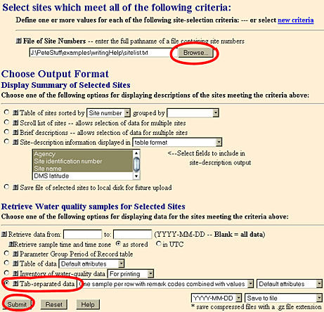
The usual web browser file download dialog, asks where to put the file. I browsed to a directory for my project, and replaced the USGS suggested file name of "qwdata" to "sitelist.txt".
Step 2: Download the Quality Data
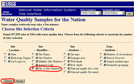
Assuming you have the right group of sites, then you use that file of site numbers to download both the quality and flow data.Go back to the original USGS Water Quality page. This time, there's only one site selection criterion: File of Site Numbers. And Submit.
LoadRunner tolerates most choices of file format, should you wish to alter other options on the Tab-separated data line. This may change (has changed...) as the USGS chooses to alter their file formats...
And Submit.
And wait. For my 3 kb file of site numbers for "Connecticut", this didn't take very long. I like to keep individual sitelist files down to 20 kb or smaller...
Eventually the browser file save dialog came up, and I named this one "qwdata.txt", right next to my "sitelist.txt". And I wait again while the file downloads - 7 Mb of data.
Step 3: Download the Flow Data
Now we move on to the USGS Surface-Water site. The first screen is site selection criteria.Here, we select File of Site Numbers and Site type (the latter is pre-selected). Site type in this context means stream flow, well water, ground water, etc. We don't want "Number of observations" because we've already chosen our sites. Submit.
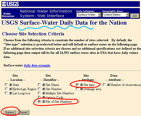
- File of Site Numbers
- Site type of Stream/River data only
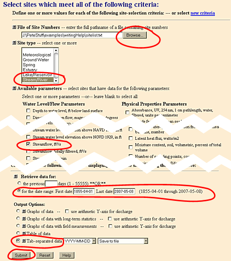
- Streamflow, ft3/s
- for a date range
- Tab-separated data saved to file
And Submit.
This immediately comes back with a browser file save dialog, and I specified a filename of "dv.txt", next to my "sitelist.txt" and "qwdata.txt" files. Then waited for the download to finish. For my example, this file was about 8 Mb.
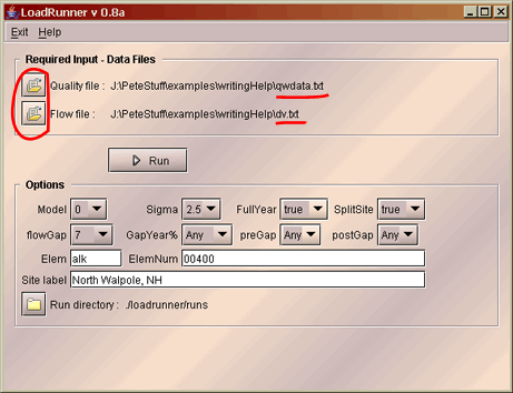
In this picture, I told LoadRunner where my "qwdata.txt" and "dv.txt" files are. I could go ahead and click Run, but I probably need to adjust the options first. Click here for a discussion of the options.
Note: Sometimes the USGS changes their output data format. If it changes too much, LoadRunner will stop working. If you believe this has happened, you might need to contact Ginger and Pete (email links below) to build another version of LoadRunner.